
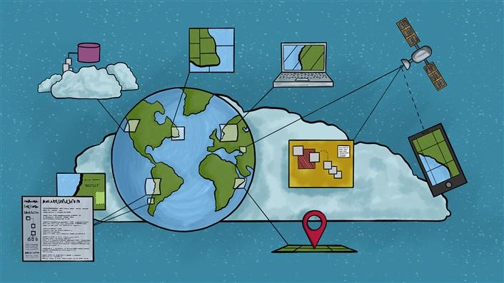
As a digital mapping tool, geographic information systems can be used across disciplines with students of varying technical expertise and comfort levels. The teaching possibilities created by interactive student projects bring life to events and people through space and time.
Educators across a wide variety of fields have used geographic information systems (GIS) in the classroom to supplement and enhance the learning experience. GIS encourages students to think creatively about spatial relationships and realities and how these factors affect human action and interaction both past and present. Digital mapping is particularly useful for teaching and learning history because it visually reminds students of the interaction between past and present.
We hail from different disciplines and schools at Indiana University Northwest in Gary, Indiana. One of us teaches criminal justice in the School of Public and Environmental Affairs and the other is in the College of Arts and Sciences and teaches early American history. Since 2015 we have collaborated on several course projects that center on using GIS to enhance the reading of course texts and to build class projects, demonstrating that the digital mapping tool may be used across disciplines with students of varying technical expertise and comfort levels. Herein we share our positive experiences teaching through GIS and provide several examples of projects as well as the pros and cons of the approach.
Teaching through GIS
Though the opportunities for projects using GIS are unlimited, we chose to create projects that permitted students to map what they were reading to expose them to history at the local, national, and even international levels. This mapping process helped bring the text to life for students and facilitated an understanding of current social issues. Our students did more than simply plot geographic points on the map; they created visual histories that can be accessed by future classes or embedded in social media platforms such as Facebook and learning management systems such as Canvas. The significance of this is that the students' learning and discoveries live beyond the class and can be used to teach others. In short, students using a GIS-centered learning tool engage in the scholarship of discovery while producing a base of knowledge that is available for future students and the public to use in their own pursuits of learning. This is a chief benefit of using GIS technology such as ArcGIS Online (or any other mapping platform) as part of one's pedagogical repertoire.
Over the years our students have been engaged in many digital mapping projects. These include mapping out the Trail of Death, which involved the systematic removal of the Potawatomi from northern Indiana to eastern Kansas by the federal government between September and November 1838; the life and presence of Abraham Lincoln in Indiana; the location of colonial cemeteries in the United States; the context of primary historical documents offered in a digital textbook; the plotting of all police-involved shootings in the United States in 2017; and the creation of a collector map to capture who and what we immortalize through statues and monuments regionally and beyond. Details about some of these projects are provided in a separate section below.
The GIS projects included both group projects and individual student projects. While there is a learning curve for most users, students report that the GIS software we chose, ArcGIS Online, is fairly learner friendly. That said, it is thought-intensive to build project maps that are easy and fruitful for students to use, requiring working ahead to make sure the projects are ready for the semester in which they will be deployed. Though far from the only technology available to enhance the student learning experience, GIS projects contribute to students' success by inviting them to engage with material in a new way. While mapping seemingly is a common tool in all of our lives, especially with the ubiquitous availability of sophisticated maps in the palms of our hands, using maps does not appear to hold a significant place in the educational experiences of our students. When surveyed, students in history courses revealed that for some, mapping had not been part of their experience since elementary school. Whether it was in fourth grade or tenth, we believe we can confidently say that the mapping that was done in elementary or high school was neither extensive nor sustained. This trend continues through college for most students.
The GIS projects require students to provide geographical and historical context by mapping locations and contributing relevant information regarding these places and how they relate to the topic under consideration, such as Lincoln's life in Indiana. Mapping the information they are reading allows students to visualize the material, not just read it—the projects are designed to facilitate learning by transforming the experience of reading. Used in this innovative manner, GIS technology allows the information—about nineteenth-century American life in the Lincoln case—to enter students' consciousness in a way that is beyond mere imagination by connecting them to actual places and spaces through which they themselves have traveled, sometimes daily. In essence, this method is conducive to a better understanding of the geospatial aspects of Lincoln's travels in Indiana and provides a way to learn beyond simply reading and recalling.
Additionally, GIS projects allow instructors to include group work without alienating a student from a project before it even begins. (We like to think of the GIS projects as the "anti-group" group projects.) Students typically dislike and resist traditional group projects for a variety of reasons. However, professors know that group projects teach essential skills that students will need in a competitive twenty-first-century economy. The software allows for a group or class to work asynchronously with flexibility and see the result of the work while the instructor is able to see the amount and quality of work each student contributed. We have found this to be effective in maintaining individual student interest in the group project before the fruits of it have fully emerged. It also allows the free-rider problem that plagues many projects at the end phase to be addressed during the project.
By taking this approach, GIS mapping becomes a student-led endeavor in which students create the data entries and the maps, leading to critical thinking and collaborative learning opportunities (i.e., they all make independent entries in the same map but learn from the other entries as well). It is a creative learning tool that an instructor or student can tailor to any item of intellectual interest, making geographic inquiry either global, national, or local. Participants are in one learning community, but the tool also allows for individual projects, making it versatile, accessible, and enjoyable to students. It is not a panacea but rather a fantastic way to engage students in groups, in classes, or as individuals with unique interests.
In our projects, we design our layers to specification in ArcGIS Desktop prior to uploading the service online. This allows us to create the fields we wish to capture, make dropdowns for data entry standardization in each field, and select settings that match the project, such as the ability to edit existing points, add or delete points, or even create attachments that pop up when the point is clicked on. We then test the layers to make sure they work properly and can be accessed by the students. Once this process is done, the map service (a set of layers that defines the mapping options) is added to ArcGIS Online and can also be accessed through ArcGIS Collector, an app for mobile devices that allows for data collection in the field. (For example, we use this in the statue and memorial map so that students can take a picture of a statue and submit it along with other useful information while they are on site at the physical location.) This process also allows students to create layers specific to their projects in the shape of points, lines, or polygons while incorporating other stock layers into their maps, making their visualizations richer and more complete. The downside to this process is the amount of time it takes to create projects and teach students how to use the maps, but that investment is small in comparison to the returns we have realized.
Examples of Our Teaching Projects
Our GIS projects lend themselves to widely acknowledged high-impact practices of undergraduate research and conference participation. Whether students create an individual project or participate in a group project, we invite them to be part of a panel to share and discuss their work at the annual College of Arts and Sciences Research Conference held on our campus. Student presenters have been well regarded by faculty and fellow students. Through the presentation of their work at the conference, students have demonstrated a high level of learning and exhibited their ability to communicate history visually through ArcGIS Online. Memorable student projects have included the path of the Lincoln funeral train, the life and wide travels of William Henry Harrison, and the battlefields of the War of 1812. For the latter, the student went so far as to use a "layer" of an 1812 US base map to indicate battlefield locations in a way that contemporaries of the War of 1812 might have experienced them visually. Thus, viewers were looking at a cartographic depiction of the United States in 1812 rather than points from 1812 on a modern map, which would skew the context of the war and its battles.
By using an early nineteenth-century map as a layer in his War of 1812 GIS project, the student demonstrated the symbiotic relationship between historical maps and GIS. The GIS maps that we use are rooted in historical maps and, as authors David Rumsey and Edith M. Punt write, the "images, narratives, and documents of human presence on Earth accrete like layers of soil—or layers of data, if one adopts the perspective of the computer and GIS." "A map," they continue, "especially a historical map, is both a kind of proto-image and super-narrative. It communicates both above and below the narrow bands of language and observation."1 We concur with that perspective.
This model can be applied to almost any discipline on campus. For example, although mapping projects are being done in early American history courses, they are also being utilized in a criminal justice course. One major ongoing project has been the crowdsourcing project in which we (the professor, two classes of students, and several students doing independent research over a summer session) have attempted to map and detail every officer-involved shooting in the United States since January 1, 2017. This allows students to critically analyze police shootings by having access to the information on all of them rather than a select few, and has them conduct primary research through direct information collection. The map has been turned into a public facing application that anyone can filter, sort, or examine to get a full picture of these critical incidents, including who was involved and what the precipitating events and outcomes were.
We have learned about police shootings in a way we could not have without the project, which had over 1,800 entries as of May 1, 2018, in every state of the country, and was worked on by over fifty students. A review of the map information greatly diminishes the idea that police shootings are predatory and provides far greater context than a list or spreadsheet ever could. It also spurred many memorable class discussions that limited opinions and instead involved concrete facts.
GIS-centered projects showcase the possibilities for not only the scholarship of discovery, but also public scholarship. Students are engaging and creating for a public audience, not simply an end-of- semester term paper for an audience of one. The tool, the activity, and the results bring into relief the relevance of what they are learning in a way that may be self-evident to us as instructors but is not necessarily so to students, especially the demographic of students we refer to as "traditional." Consider the following example: Enthused by the Lincoln in Indiana GIS project, a student from Lake Station, Indiana, visited her local historical society. There she learned that Lincoln was said to have stayed at the town's Audubon Hotel. Further research, however, and a trip to the Abraham Lincoln Presidential Library and Museum in Springfield, Illinois, revealed that this story was part of local lore that the Chicago Tribune perpetuated in 1947 without any evidence. The experience awakened the student's historical consciousness. She learned the difference between history and memory and also gained an understanding of historical geography. Upon going into the map to plot the spatial history, she found that where the hotel (and center of a Lincoln legend) once stood is now the site of a Walgreens that she passes regularly in her day-to-day life. Furthermore, the plotting of the map led to an in-class discussion that covered national, state, and local history as well as issues of historical memory and research methodologies. Students had an opportunity to consider seriously how places and spaces fit into our historical consciousness and imaginations. The mapping aspects inherent in the GIS and student-centered projects stimulated this multitiered learning experience.
In addition to the technology-impacting learning through creative pedagogy that is readily assessable, the use of GIS technology in this manner facilitates meeting general learning objectives in twenty-first-century American higher education. First and foremost, the tool is designed to enhance information literacy through the application of an effective learning technology. Students are learning a new technology (GIS) as they learn history in new, exciting, and relevant ways. GIS also fosters cultural and historical studies by encouraging students to seek out and analyze historical and contemporary realities, both locally and globally. This learning technology encourages critical thinking as well as the integration and application of knowledge. The GIS projects require students to seek out information and to evaluate its trustworthiness, value, and relevance. Finally, GIS-centered projects welcome students to learn about the diversity of peoples, the never static reality of human geography and contact, and the social structures that result from the consequent development of cultures and the challenges to those cultures. To us, the project that called on students to map the Trail of Death in Indiana illustrated these points clearly and poignantly while demonstrating the potential for GIS projects to have a deep and wide impact on students and professors alike. This is critical at a time when many students cannot find states or countries on a map as the world gets more connected. This technology helps to address that problem. In addition, one of the professors who worked on this project had never heard of the Trail of Death and was taught about it through the student mapping, completing the cycle of teaching between professor and student.
Like the technology widely available today and the social media that permeate countless lives across the globe, GIS projects encourage students to see local and national events in a broader context. They learn, as they did by developing a digital map in the Colonial and Revolutionary America course, that events in Boston and Williamsburg were not unrelated to events in Barbados, London, or India. Many of the colonial cemeteries they mapped were surrounded by homes and other buildings, showing their physical place in our history amidst development. Furthermore, while GIS projects offer a visual and cartographic image of what is being read and learned and a reminder that our national narratives are tied to geography, the students also learn that contemporary discussions of violence are broader in scope than might otherwise be sensed if one takes in the news via radio or television. Finally, they see the lineage of tragic human interactions from the nineteenth-century Potawatomi to the streets of modern America, often overlapping.
The Pros and Cons of Teaching through GIS
We paint a rosy picture here of the benefits to students, professors, and the wider public when using GIS in teaching, but that outcome for us was the result of much trial, error, and frustration that was experienced by both professors and students in the beginning. Teaching through GIS is time and thought intensive and requires advance preparation to make projects meaningful. One positive is that any project is possible if one is creative enough. Turning an idea into reality does require technical skill in a desktop GIS program. This is why we have undertaken and advocate cross-disciplinary collaboration between professors in different fields, departments, or schools.
There is also the issue of student ability, but this is true of the use of any technology, class, or group project. We encountered a few students who were just resistant to the software if they encountered any issue at all, but that is not unique to teaching through GIS. We used in-class sessions to teach the software for the project itself rather than teaching broader uses of GIS or technical skills. This was due to the time constraints of class meetings. To overcome this, we created tutorial videos that could be embedded into Canvas and watched by the students who were struggling. That said, it is difficult to leave time in the semester to design the final product in a more polished format, so that is something we continue to work on.
We as professors also had frustrating issues that had to be resolved. Our Lincoln in Indiana map was perfectly suited for an ArcGIS Story Map but we struggled to create it because the template was not user friendly. This required us to expend a fair amount of time working with and learning the template because we knew this would be the best medium for visualizing the information. This process continued after the class ended and remains a work in progress.
Although we chose to use ArcGIS for our projects, other mapping software platforms may be free or cost less or be more user friendly. We do not seek to push a single software here and believe that a variety of platforms can achieve the same goals. That said, professors should carefully select the mapping platform that works best for them and allows them to pull the data entered back out for research and other related endeavors. Despite the drawbacks discussed above, we have concluded that the value of teaching with GIS far outweighs the costs in our experience.
In Closing
Students have consistently noted how much they have learned from and enjoyed the mapping projects—and they have taught us a great deal about what they learned. One student mapped the treaties signed by William Henry Harrison that essentially created three-fifths of modern Indiana, teaching us how much of our state he negotiated and acquired from the various American Indian tribes that inhabited the area. She taught us through her learning. There is probably no greater value for students than to use a medium that allows them to teach others and to share this creative work with friends on social media with a click of the mouse.
Though our GIS projects turned out to be time intensive, we wholeheartedly believe in the teaching possibilities created by interactive student projects that bring life to events and people across space and time as communicated through maps. We hope that others, through reading this short essay, already have creative ideas of their own that they will try out and share with academia and the wider public. We look forward to learning from those maps ourselves.
Note
- David Rumsey and Edith M. Punt, Cartographica Extraordinaire: The Historical Map Transformed (Redlands, CA: ESRI Press, 2014). ↩
Christopher J. Young is an Associate Professor of History and Director of the Center for Innovation and Scholarship in Teaching and Learning at Indiana University Northwest.
Joseph Ferrandino is the Director of the School of Criminal Justice at Ferris State University and was an Associate Professor of Criminal Justice at Indiana University Northwest.
© 2018 Christopher J. Young and Joseph Ferrandino. The text of this work is licensed under a Creative Commons BY-ND 4.0 International License.